
Morristown ZIP Code Coverage
The primary Morristown postal reference has four labels: two standard delivery routes and two routes identified as post-office-box use. They are delivery designations, not neighborhood maps. USPS did not expose a verified returned Morristown search result or a city-limit overlay during research, so the table keeps to the route types and cautions that are documented. A full street address, including unit when relevant, remains the best way to check a delivery ZIP.
| ZIP | Delivery coverage supported | Post-office or routing clue | Verification note |
|---|---|---|---|
| 37813 | Standard delivery associated with Morristown and Hamblen County addresses | Morristown Post Office, 803 S Cumberland Street, uses 37813-9998 | The postal label can include county pockets outside the incorporated city |
| 37814 | Standard delivery associated with Morristown | Appears in historical USPS routing descriptions | Confirm station assignment and the exact address with USPS |
| 37815 | PO Box route associated with Morristown and Hamblen descriptions | Postal-box designation rather than a situs geography | It cannot identify a home, parcel, or neighborhood |
| 37816 | PO Box route associated with Morristown and Hamblen descriptions | Box or station details need USPS confirmation | It is not a city-limit map |
| 37877 | Talbott-associated route in Morristown routing history | USPS material ties it to a 37813 label-container change | Routing history is not an annexation finding |
Regional references also place 37860 with Russellville and 37890 with White Pine. Those nearby postal places should not be counted as Morristown city ZIPs without a specific USPS result. A mailing address may describe an unincorporated Hamblen County property, while a parcel may use a nearby post office for delivery.
Note: Use a ZIP label to narrow a mailing question, then use USPS, GIS, and parcel records for the separate delivery and jurisdiction answers.
Morristown Postal Route Clues
The Morristown Post Office record identifies the facility at 803 S Cumberland Street with the 37813-9998 ZIP+4 format and published retail, lobby, collection, and PO Box access hours. Those operating details can change, so the post-office page should be checked before a visit. The office record helps confirm a postal contact point, but a PO Box or a mailing line does not establish where someone lives or where a parcel lies.
USPS offers a narrower answer when the requester has an actual address. Its By Address mode accepts a street address with city and state, and it can include an apartment, suite, or other unit. The service warns that a ZIP result does not confirm a person or company at the address. That warning matters when a Morristown mailing line appears in a deed, directory, or court file.
The Morristown Post Office location record is the source for the facility details used in this postal reference.
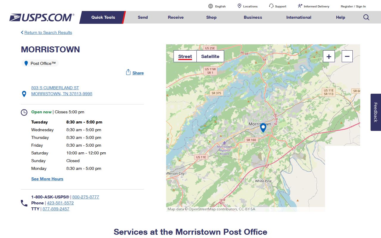
The facility screen is useful for postal service details, while an address query remains the route for an exact delivery ZIP or ZIP+4 check.
Morristown ZIP Code Searches
A ZIP can reduce an address search, but it does not create a verified resident list. Start with USPS to normalize a known delivery address. Then use Tennessee Property Assessment Data for the Hamblen County parcel that matches the street clue. TPAD searches county plus an owner name, property address, subdivision, classification, sale-date range, or parcel identifier. Research did not verify a ZIP-only TPAD filter, a public Hamblen GIS viewer, or a ZIP-based voter-result view, so do not assume those options exist.
- Use USPS ZIP Lookup to check the delivery format for the exact street address, city, state, and unit when known.
- Select Hamblen County in TPAD, then search a street fragment, owner clue, subdivision, or parcel identifier instead of assuming the ZIP is searchable there.
- Compare the parcel's situs and mailing fields, Control Map, Group, and Parcel values. Ask County or City GIS to verify address, jurisdiction, or street history when the portal does not settle the question.
- Use the voter lookup only for its documented county, first-name, last-name, birth-month, and birth-year inputs, and use the Election Commission for the appropriate public-record route.
Once a ZIP is narrowed to a street, the Morristown street directory explains the address-keyed parcel, deed, and GIS trail. It is the better route for a full named-street question.
Morristown USPS Search Fields
USPS captured three lookup modes: By Address, By City and State, and Cities by ZIP. The address form is the most specific documented route for a Morristown postal lookup because it includes the delivery line itself. The other two modes can supply a city or ZIP relationship, but they do not settle whether a particular building is inside a municipal boundary.
| USPS field or mode | Visible requirement or use |
|---|---|
| Company | Optional on the By Address form |
| Street Address | Required for the documented By Address search |
| Apt, Suite, or Other | Optional unit detail for a narrower delivery check |
| City and State | Required on the documented address form |
| ZIP | Optional on the address form when checking an existing postal clue |
| By City and State / Cities by ZIP | Alternative modes for a broader postal lookup |
Research did not capture a returned local USPS result. A screen with no visible result should be treated as an unverified output, not as proof that an address has no valid route.
Note: Use the precise address and unit when available, because broader ZIP and city searches cannot settle a delivery question.
Morristown Parcel Geography
A Morristown ZIP label and city geography answer different questions. USPS supplies delivery routing. County and City GIS handle address verification, jurisdiction, street naming, parcel geography, zoning, and related map questions. TPAD holds the county assessment display. The Register of Deeds holds recorded instruments. When a mailing address and parcel record disagree, preserve both forms, note the date, and ask the relevant office which record controls the question being asked.
Insider tip. The parcel identifier is more stable than a mailing line. Save TPAD's Control Map, Group, and Parcel fields before asking GIS or the Register of Deeds to reconcile an older address, subdivision label, or postal change. A TPAD assessment card can locate a parcel and owner display, but it is not a deed and does not prove title or full occupancy history.
The Census QuickFacts reference for Morristown provides city-scale context, not a postal boundary for an address search.
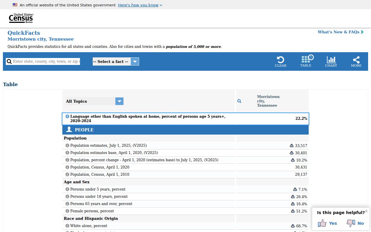
The Census place count and land-area context cannot be used to assign a ZIP or decide whether a parcel lies within a particular city jurisdiction.
Morristown ZIP Routing Change
Postal history can explain an apparent conflict in older records. The 2023 USPS Postal Bulletin describes label-container changes involving 37813 and 37815 from 37814 to 37813, and it places 37877 in the Morristown 37813 routing context. That is a sorting and labeling change. It does not establish that a Talbott address became part of Morristown or that a boundary shifted.
Preserve the date of the letter, directory, deed, or mailing record before comparing its ZIP to today's format. A historical street may also use a community name such as Russellville, Whitesburg, Springvale, or Panther Springs. County formation, post-office practice, city growth, and postal routing are related research layers, but they are not interchangeable geographic evidence.
The 2023 USPS Postal Bulletin notice records the routing change referenced in local address research.
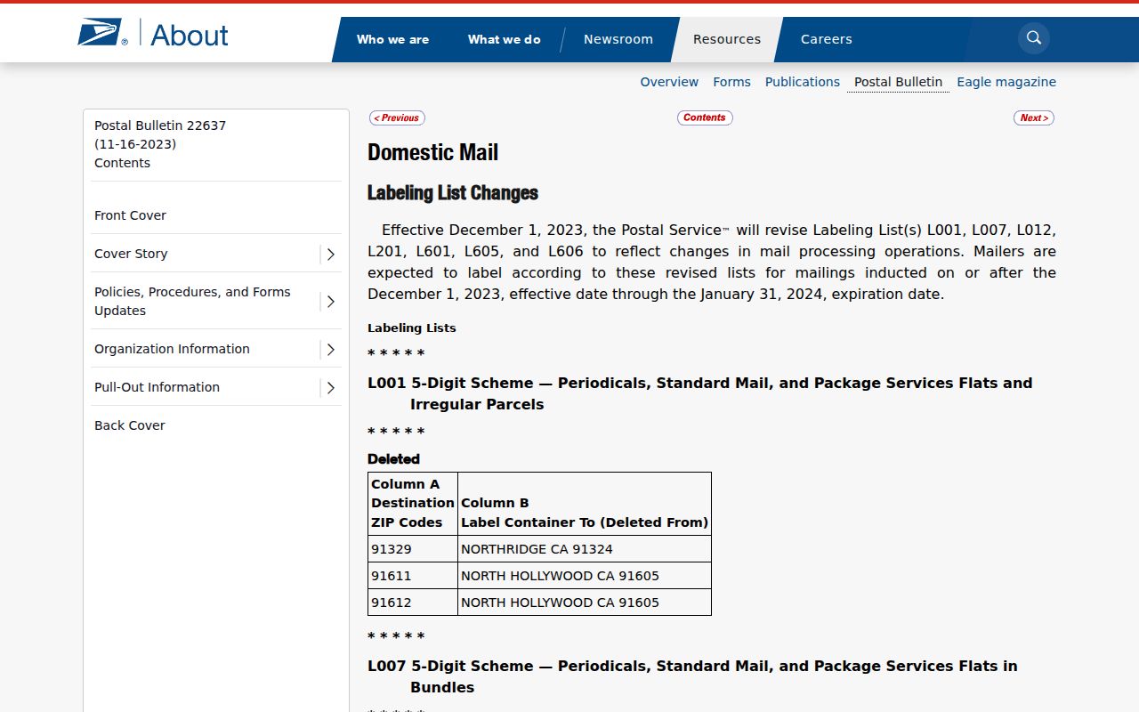
Read the bulletin as a dated postal-routing source. Pair it with a current USPS lookup and a local parcel or GIS record before interpreting a change in an address history.
Note: A new postal container label can change how mail is sorted without changing a city's limits, a parcel, or a deed description.
Morristown ZIP Code Boundaries
A city line, county line, Census place, precinct, parcel, and ZIP route are separate geographies. A Morristown mailing address can serve an unincorporated Hamblen County property, and a Hamblen parcel can use a nearby postal place. The research did not locate an official USPS map assigning every Morristown street or neighborhood to a city boundary. USPS should establish delivery format; County or City GIS should establish local jurisdiction; TPAD should identify the assessment parcel; and a deed or plat should supply the legal description.
- ZIP and ZIP+4
- A ZIP directs mail to a broad routing area. ZIP+4 adds a smaller delivery segment and must be checked against the exact address.
- PO Box ZIP
- A postal-box route identifies where mail is collected. It is not the address of a residence, parcel, or neighborhood.
- Unique ZIP
- A ZIP assigned to one organization or large receiver. Research did not verify a Morristown unique ZIP, so none should be assumed.
- Carrier route
- A postal delivery grouping used to move mail. It is not a legal boundary or a population district.
| Question | Best Morristown source | What it cannot decide alone |
|---|---|---|
| Which format should mail use? | USPS address lookup | Parcel ownership or city jurisdiction |
| Which local government covers an address? | Hamblen or City GIS | Current delivery ZIP or title |
| Which parcel matches a street clue? | TPAD and Assessor | Complete ownership chain |
| What legal land description applies? | Register of Deeds deed or plat | Postal delivery route |
Boundary caution. Do not use a Morristown ZIP code as proof of residence, ownership, incorporated-city status, or a person's current location. Confirm the specific question with its proper custodian.
Morristown ZIP Code Records
Record check. A postal query does not create a resident directory. USPS says a ZIP result does not confirm that a person or company is located at an address. A TPAD owner display can be a useful parcel clue, but an assessment card is not title evidence. A deed can establish a recorded land connection, while historic directories, tax books, city minutes, newspapers, and probate files provide dated context for older addresses. Each source must keep its own date and purpose.
For historical work, Hamblen County Archives and Tennessee State Library and Archives hold records beyond the public web layer. The TSLA inventory lists Morristown city minutes from 1855 through 1996 in roll segments, along with deeds, tax books, probate, and other county material. Ask for a roll, volume, or date range instead of requesting a broad ZIP-based file that a custodian may not maintain.
When a postal clue points to a property, keep the original mailing line and the current USPS result together. That record trail makes a later parcel, deed, or archive check easier to explain.